GPS tracks, routes, trails, hikes

GPS tracks visualization and sharing, free and without registration.

Import a GPX file

Galu Devi temple - Triund Hill

#Hike

  • Distance: 8.1 Km
  • Elevation gain: 1,402 m
  • Maximum elevation: 3,230 m
  • Elevation loss: 289 m
  • Minimum elevation: 2,103 m

Interactive map

GPS track profile

About this GPS track

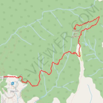
Name: Galu Devi temple - Triund Hill GPS track, route, trail.
Start: Sun & Moon Cafe, Triund Trail 1, Galu Devi, Haini, Dharmsala, Kangra, Himachal Pradesh, 176216, India (32.25500 76.32640)
End: Kunal Pathri Devi Temple, Triund Hill Top Trail, Dharmsala, Kangra, Himachal Pradesh, 176216, India (32.26979 76.35268)
Coordinates: 32.25216 76.32640 32.27384 76.36158

Other GPS tracks

Manali - Kargil

India > Himachal Pradesh > Manali > Old Manali

#Bike #Zanskar

Distance: 527.6 Km - Elevation gain: 12,997 m - Maximum elevation: 5,039 m - Coordinates: 32.24578 75.92972 34.55897 77.26204

Start: Mountain Dew Cafe, Peddler Street, Old Manali, Manali, Kullu, Himachal Pradesh, 175131, India (32.25439 77.17675)

End: HDFC Bank, Main Bazzar, Kargil, Kargil tehsil, Ladakh, 194103, India (34.55851 76.12651)