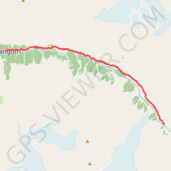
Gangotri - Bhojwasa
#Hike
- Distance: 16.2 Km
- Elevation gain: 1,387 m
- Maximum elevation: 3,809 m
- Elevation loss: 660 m
- Minimum elevation: 3,049 m
Interactive map
GPS track profile
About this GPS track
Name: Gangotri - Bhojwasa GPS track, route, trail
Start: Gangotri, Bhatwari, Uttarkashi District, Uttarakhand, India (30.99499 78.93899)
End: Kalindi Pass, Bhatwari, Uttarkashi District, Uttarakhand, India (30.94969 79.05135)
Coordinates: 30.94969 78.93899 30.99726 79.05143
Topography: Bhatwari topographic map