Amasa Back, Moab (Utah)
Interactive map
GPS track profile
About this GPS track
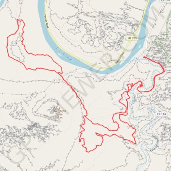
Name: Amasa Back, Moab (Utah) GPS track, route, trail
Start: Kane Creek, Kane Springs Road, Grand County, Utah, États-Unis d'Amérique (38.53261 -109.60065)
End: Kane Creek, Kane Springs Road, Grand County, Utah, États-Unis d'Amérique (38.53259 -109.60062)
Coordinates: 38.50909 -109.64428 38.54215 -109.59390