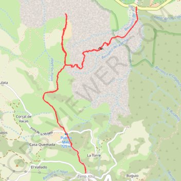
Camino del Risco - Teno Alto
Randonnée en aller-retour depuis Buenavista del Norte. #Randonnée
- Distance: 8.2 Km
- Elevation gain: 794 m
- Maximum elevation: 775 m
- Elevation loss: 794 m
- Minimum elevation: 114 m
Interactive map
GPS track profile
About this GPS track
Name: Camino del Risco - Teno Alto GPS track, route, trail
Coordinates: 28.34350 -16.88190 28.36102 -16.87063
Other GPS tracks
Click on a GPS track to view route, its statistics and profile.
Faro de Teno
Espagne > Buenavista del Norte > Teno Alto
Punta de Teno. #Randonnée
Distance: 6.8 Km • Elevation gain: 23 m • Maximum elevation: 772 m