Import a GPX file

Sugarloaf Scenic Reserve Loop

Loop hike in the Sugarloaf Scenic Reserve via Cedrics Track, Gilpins Track and Mitchells Track. #Hike #Loop #Nature #Forest #Mountain

  • Distance: 4.9 Km
  • Elevation gain: 321 m
  • Maximum elevation: 456 m
  • Elevation loss: 312 m
  • Minimum elevation: 329 m

Interactive map

GPS track profile

About this GPS track
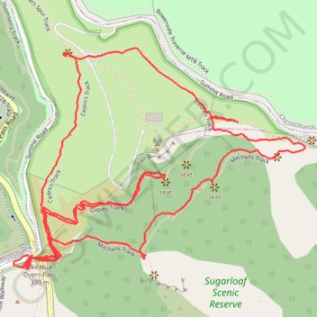
Other GPS tracks

Click on a GPS track to view route, its statistics and profile.

Tour Te Waipounamu

New Zealand > Tasman > Tasman District > Port Pūponga

Bikepacking race through the South Island of New Zealand. #Bike #Race #Island #Sea #Pacific #Ocean #Nature #Mountain #Forest #Countryside

Distance: 1,321.0 Km • Elevation gain: 23,362 m • Maximum elevation: 1,946 m