Stonewall Peak
Hike to Stonewall Peak in the Cuyamaca Mountain State Wilderness. #Hike #Mountain #Nature #Forest #Wilderness
- Distance: 3.1 Km
- Elevation gain: 249 m
- Maximum elevation: 1,722 m
- Elevation loss: 25 m
- Minimum elevation: 1,494 m
Interactive map
GPS track profile
About this GPS track
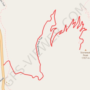
Name: Stonewall Peak GPS track, route, trail
Start: Stonewall Peak Trail, San Diego County, California, United States (32.95971 -116.57909)
End: Stonewall Peak Trail, San Diego County, California, United States (32.96090 -116.57196)
Coordinates: 32.95851 -116.57909 32.96403 -116.57132