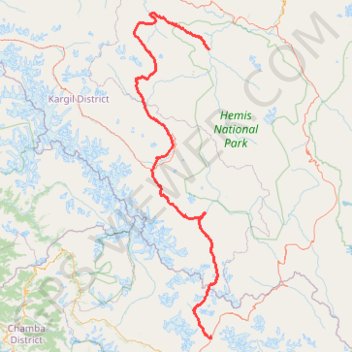
Ladhak Trek
Darcha, Panjilla, Chilling. #Hike
- Distance: 342.2 Km
- Elevation gain: 14,524 m
- Maximum elevation: 5,043 m
- Elevation loss: 14,731 m
- Minimum elevation: 3,189 m
Interactive map
GPS track profile
About this GPS track
Name: Ladhak Trek GPS track, route, trail
Coordinates: 32.67040 76.77614 34.20876 77.25107
Topography: Lahul topographic map
Other GPS tracks
Click on a GPS track to view route, its statistics and profile.