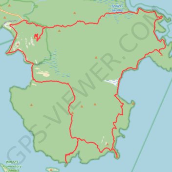
Wilsons Promontory Circuit
Wilsons Promontory Marine National Park. #Hike #Loop #WilsonsPromontory
- Distance: 72.6 Km
- Elevation gain: 3,239 m
- Maximum elevation: 539 m
- Elevation loss: 3,239 m
- Minimum elevation: 0 m
Interactive map
GPS track profile
About this GPS track
Name: Wilsons Promontory Circuit GPS track, route, trail
Coordinates: -39.13433 146.31809 -39.01859 146.47107
Other GPS tracks
Click on a GPS track to view route, its statistics and profile.
Wilsons Promontory Southern Circuit
Distance: 46.3 Km • Elevation gain: 1,717 m • Maximum elevation: 307 m
Wilsons Promontory Southern Circuit
Distance: 46.3 Km • Elevation gain: 1,724 m • Maximum elevation: 307 m