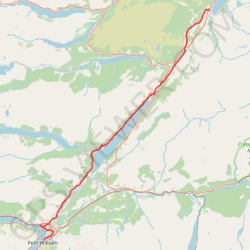
Great Glen Way (Fort William to Fort Augustus)
- Distance: 52.6 Km
- Elevation gain: 598 m
- Maximum elevation: 108 m
- Elevation loss: 580 m
- Minimum elevation: 0 m
Interactive map
GPS track profile
About this GPS track
Name: Great Glen Way (Fort William to Fort Augustus) GPS track, route, trail
End: A82, Blairconard, Fort Augustus, Highland, Scotland, PH32 4DJ, United Kingdom (57.14518 -4.68080)
Coordinates: 56.82091 -5.11875 57.14518 -4.68080
Other GPS tracks
Click on a GPS track to view route, its statistics and profile.